
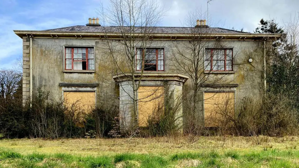
Picture: Crevagh House, Omagh | Kenneth Allen/Geograph
Ulster Architectural Heritage (UAH) has issued an update to its ‘Heritage in Flames’ Fire Map, warning that the case of the Antrim Arms is not isolated, and that the risk to Northern Ireland’s historic buildings is not only increasing — but increasingly predictable.
Analysis underpinning the Fire Map shows that 37 listed buildings have been damaged by fire since 2015. The latest update incorporates a number of recent incidents, four since the start of 2026 including Crevenagh House, Omagh, County Tyrone; Upperlands Mill Complex near Maghera, County Derry-Londonderry; Abbey House, in the grounds of Whiteabbey Hospital, Newtownabbey; as well as the Antrim Arms. Alarmingly, this is not the highest rate of such incidents. At least eight listed buildings were damaged or destroyed in the first six months of 2025 alone. The fire map highlights a clear and recurring pattern affecting the region’s built heritage. With occurrences hitting one or more listed buildings a month, such high numbers of listed historic buildings affected by fire or arson is a tragic pattern of destruction, that cannot continue.
Vacancy leads to deterioration. Deterioration leads to vulnerability. Vulnerability leads to fire — and ultimately, loss.
The high numbers of incidents across Northern Ireland demonstrates fire is not a random occurrence, but a foreseeable outcome of neglect. The data highlights a consistent tale: buildings that fall vacant are more likely to deteriorate, become insecure, and ultimately suffer fire damage. In many cases, fires are believed to be deliberate, with vacant and unprotected properties particularly vulnerable to arson. Interventions such as maintenance, repair, keeping buildings occupied, and in use are the obvious solutions to sustain built heritage and prevent such tragedies. Where buildings are vacant, buildings need to be kept in good condition and secure.
By mapping incidents across Northern Ireland, the Fire Map transforms individual events into a broader, evidence-based picture of risk. The map is underpinned by data collected by UAH in partnership with the Department for Communities for the Heritage at Risk Register.
The Heritage at Risk Register is a vital tool in tracking vacancy and vulnerable heritage. It is a useful resource for the Department for Communities, Historic Environment Division and local councils to use to monitor buildings that may be vulnerable, and more proactively target resources and where necessary, powers of regulation and enforcement, such as Urgent Works Notices and Compulsory Purchase Orders in a timely fashion, halting the trajectory in its tracks.
However, the Society warns that existing statutory powers are not being used effectively.
Tools such as Urgent Works Notices and Compulsory Purchase Orders exist to enable intervention before buildings reach a critical point of vulnerability. Yet, despite the availability of these mechanisms, there is little evidence of consistent or proactive enforcement, allowing buildings to deteriorate to the point where fire becomes increasingly likely. UAH calls for more effort from central and local government in this regard.
UAH analysis of data in the fire map shows that total loss outcomes are not inevitable. The project also documents cases where buildings severely damaged by fire have been successfully stabilised, restored, and returned to use. UAH warns that without intervention, further losses are inevitable.
The Heritage at Risk Register and The Fire Map, exist to ensure that risk is no longer invisible — and that the opportunity to act comes before, rather than after, the damage is done.
Published: 21st April, 2026